
Antverpia, Joris Hoefnagel

Joris Hoefnagel drew a beautifully detailed map of the city of Antwerp and the citadel, showing the city from a bird’s eye perspective. The cityscape and the main landmarks can be spotted on it. The print was published in the book Civitates Orbis Terrarum, published in the period from 1572 to 1616.

From the Print Cabinet's collection

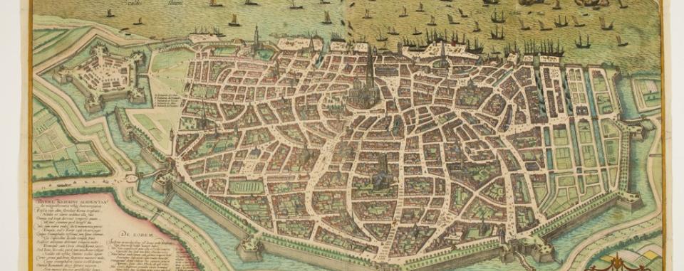
This is a beautifully detailed map of the city of Antwerp and the citadel in the form of a bird’s eye view.

The cityscape and the main landmarks can be spotted on it. An historical note and legend appear at the bottom left. The print appeared in the book Civitates Orbis Terrarum, published by Braun and Hogenberg in the period 1572 to 1616.


Museum Plantin-Moretus

Unesco werelderfgoed

Slogan icons

Subscribe to our newsletter